Wave Whisperer™
Read the buoy. Watch the water. Train your call.
Buoy School: how a buoy works, and which ones are out there.
A buoy is a floating accelerometer. As it is moved by ocean swells,
the vertical rise and fall measures period and strength while tilt and push signal direction.
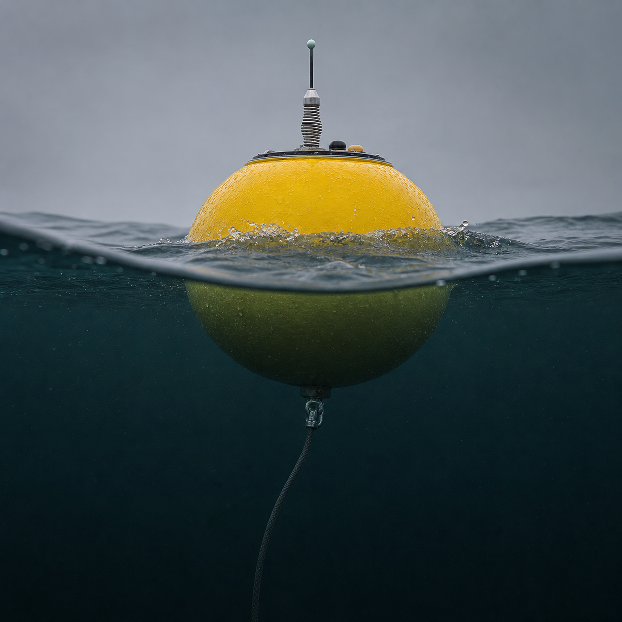
How it senses a wave.
The sphere below is a Datawell Waverider, the model Scripps moors off the California coast.
- The hull rides the surfaceA stainless sphere about 3 ft across, moored to the seabed on a long elastic tether so it can follow the water instead of fighting it.
- A weighted platform stays levelInside, a disc floats in fluid within a plastic sphere. Gravity holds it flat no matter how the hull pitches, which gives the sensor a true vertical to measure against.
- Measures acceleration, not heightIt records vertical acceleration as the buoy rises and falls. Integrate that twice and you have displacement: the wave height.
- Horizontal sensors add directionTwo more accelerometers plus a compass track which way the buoy is being pushed, which is where swell direction comes from.
- It phones home every 30 minutesAn Iridium transmitter uplinks to a satellite, down to a gateway in Honolulu, then to Scripps in La Jolla. That is the delay you see in the timestamp.
What is on top.
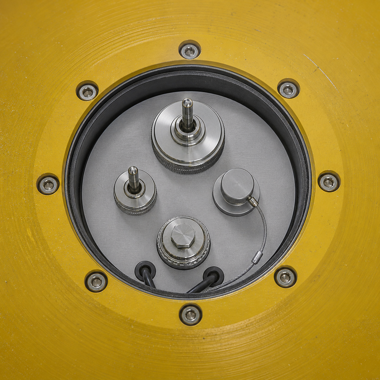
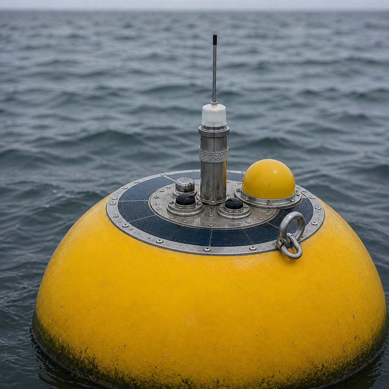
Two shapes, two agencies, one ocean.
The readings in this app come from both. They look nothing alike and they are run by different agencies.
CDIP · 3-digit number
The sphere
Coastal Data Information Program, run by Scripps Institution of Oceanography since 1975. Small Waverider spheres, moored close to shore, built to measure waves precisely and little else. Numbered 028, 191, 201.
NDBC · 5-digit number
The discus
National Data Buoy Center, part of NOAA. Large 3, 10 and 12 metre discus hulls and 6 metre boat-shaped NOMADs, moored far offshore, carrying wind, pressure and air temperature as well as waves. Numbered 46221, 46232, 46254.
Not navigation marks. NOAA's stated mission for them is "collecting and disseminating in-situ, real-time, quality-controlled observations in the marine environment to ensure the Nation's maritime safety." The lit buoys marking a harbour entrance are Coast Guard aids to navigation, an entirely separate network.
Both at once
Same buoy, two numbers
Many stations are registered in both systems, so one buoy carries two unrelated numbers. Ocean Station PAPA is CDIP 166 and NDBC 46246. That is why every table here lists both, always.
The four numbers on the screen.
What the buoy actually reports, and what it does not.
Height
The average of the highest third of waves, not the biggest one. Every swell in the water added together, so one reading can be three swells stacked.
Period
Seconds between crests, for the swell carrying the most energy. Under 11 is usually local wind. Over 16 is a storm a long way away. Average period, a switch in the app, counts every wave in the spectrum, not just the peak. Chop pulls it down, so it usually reads shorter.
Direction
Where the energy comes from, in degrees true. Whether your spot is open to that angle is the whole question, and the buoy cannot answer it.
Sea surface temp
Measured at the waterline, not at depth. Good for what to wear, and for spotting upwelling when it drops several degrees in a day.
Live right now from CDIP 028 / NDBC 46221, Santa Monica Bay.
The ten in Wave Whisperer.
Live readings, refreshed every half hour. Open Locate on any row to see where that buoy actually sits.
Every other wave buoy in the North Pacific.
NOAA lists 379 active stations in the North Pacific, from Baja to the Aleutians and out to Hawaiʻi. Only 138 are buoys, and just 109 stations report waves at all: the ten above and these 99. The rest are wind-only towers and tide gauges on piers and platforms (224), 14 DART tsunami buoys that watch the seabed rather than the surface, and buoys carrying no wave sensor.
| CDIP | NDBC | Station | Closest town | Reporting |
|---|
Where to learn this properly.
People who show their work. No hype, no wave-height inflation.
Mark Sponsler has been forecasting since 1985 and gives the whole method away. The closest thing to a free course in reading buoys.
Wrote the first comprehensive book on surf forecasting, and teaches it from free public buoy data rather than a paid feed.
Written for surfers rather than engineers. The best answer to "what is that yellow thing out there".
Kevin Wallis's team on why one significant wave height is often three separate swells stacked.
Scripps documenting its own hardware. How a Waverider senses a wave, in plain language.
The path a reading takes: hull, to Iridium satellite, to Honolulu, to La Jolla, to your phone.
NOAA's four hull types with dimensions. The 3m discus is what most of the offshore numbers come from.
The manufacturer. Specs and manuals for the sphere itself, including the sensor cutaways.
The modern counterpoint: 600-plus small solar buoys, drifting, feeding forecast models directly.
Peer-reviewed, on assimilating buoy spectra into wave forecasts. For when you want the actual paper.